
Travel to Cabo Verde
 3 photos
Cape Verde, officially the Republic of Cabo Verde, is an island nation comprising ten volcanic islands in the central Atlantic Ocean, roughly 600 kilometers west of Senegal. Known for its political stability, Creole culture, and scenic coastlines, it stands as one of Africa’s most democratic and prosperous small states.
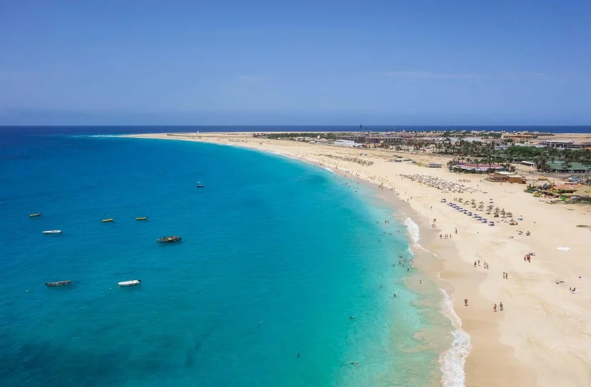
The archipelago divides into the northern Barlavento (Windward) and southern Sotavento (Leeward) groups. Rugged volcanic peaks such as Pico do Fogo (2,829 m) contrast with flat desert islands like Sal and Boa Vista. A dry tropical climate, limited rainfall, and recurring droughts have shaped settlement and livelihoods. Despite scarce freshwater, efforts in reforestation, desalination, and renewable energy (targeting 50% by 2030) exemplify adaptation to climate stress.
Hotels in Cabo Verde
 Cidade Velha
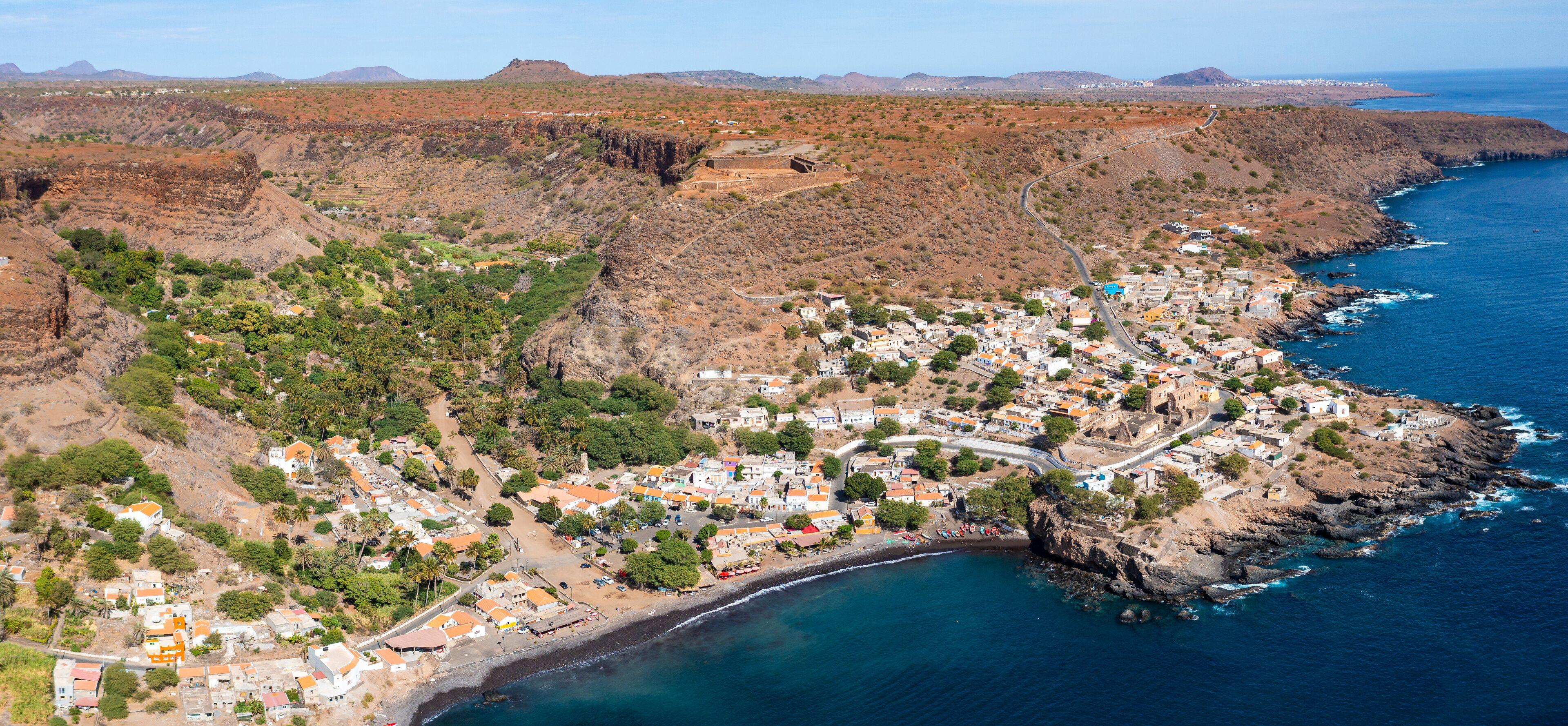
Cidade Velha is a historic town on Santiago Island in Cape Verde and the country's oldest settlement. Founded in 1462 as Ribeira Grande, it became the first European colonial town in the tropics and was inscribed as a UNESCO World Heritage Site in 2009 for its exceptional historical and cultural significance. Founded during the early period of Portuguese Atlantic expansion, Cidade Velha served as the first capital of Cape Verde and an important maritime hub linking Europe, West Africa, Brazil, and the Caribbean. It played a central role in the development of Atlantic trade routes, including the transatlantic slave trade, making it a place of both remarkable historical importance and profound human tragedy.
 Explore Santo Antão
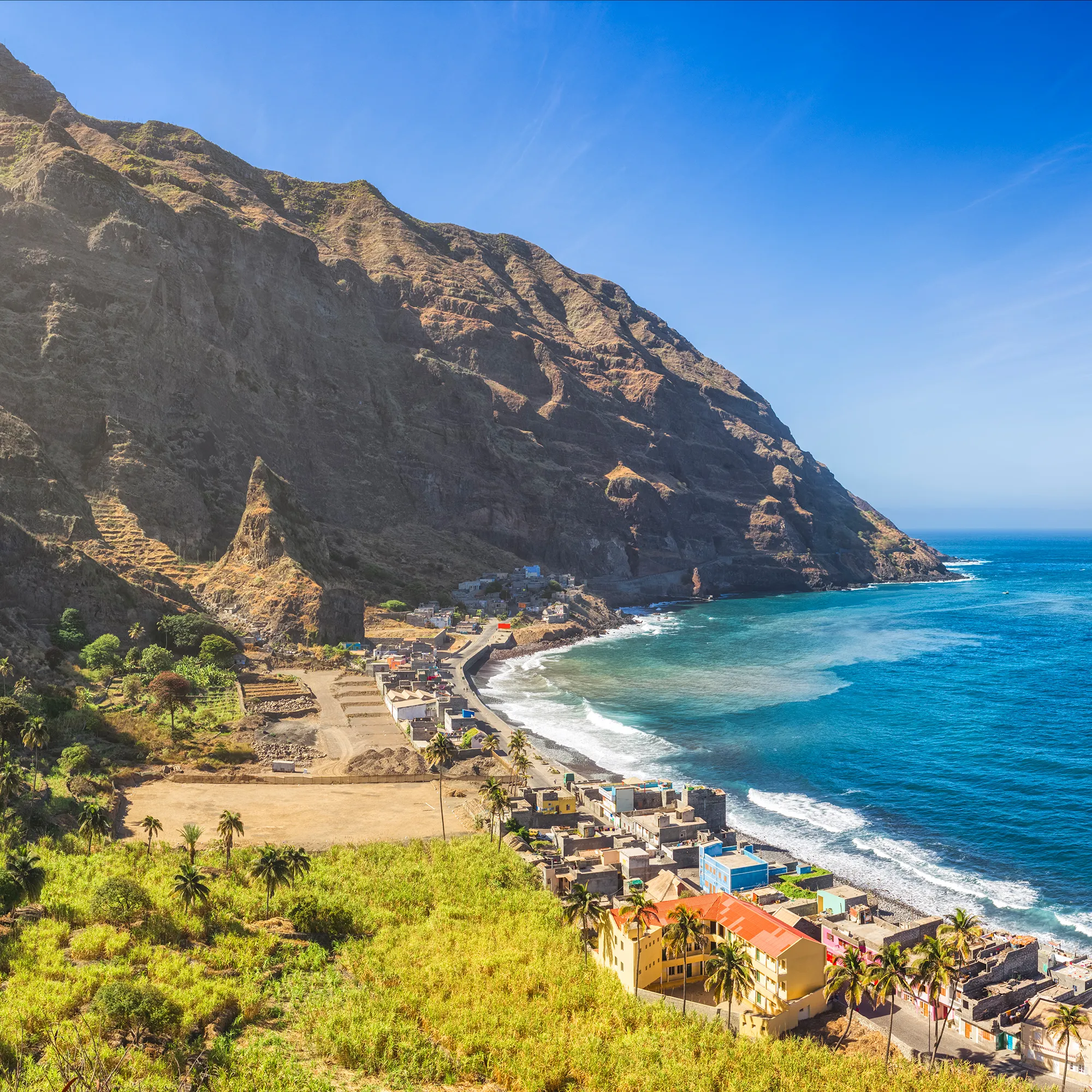
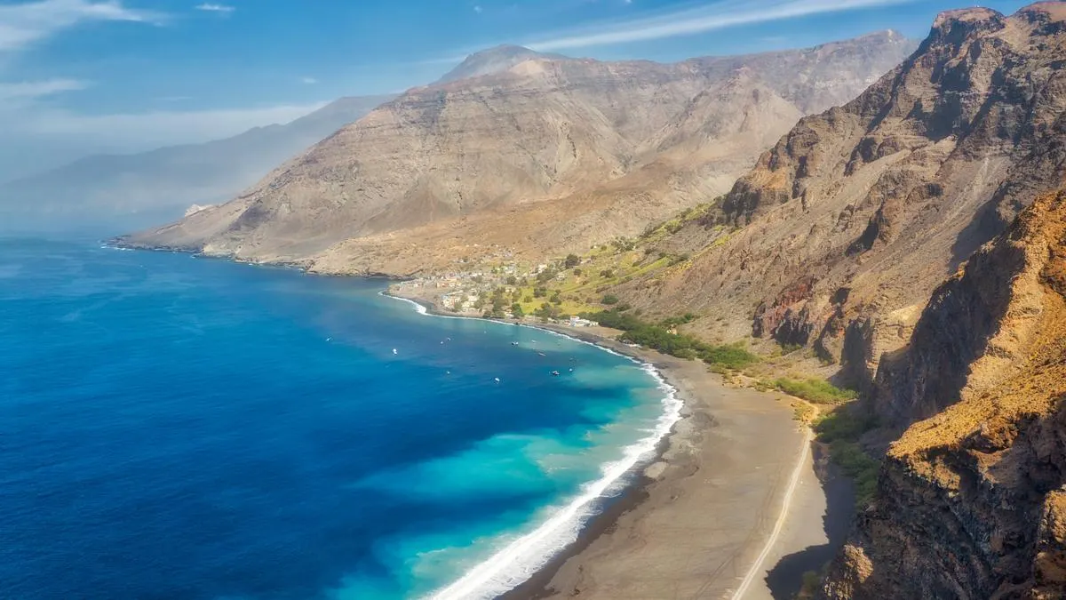
Santo Antão is the northwesternmost inhabited island of the Cape Verde, renowned for its dramatic volcanic mountains, deep green valleys, and rugged Atlantic coastline. It is widely regarded as one of the country's premier hiking destinations, with landscapes that contrast sharply between the arid south and the lush northeastern valleys shaped by trade winds. Volcanic origins define Santo Antão's terrain, with steep peaks rising above deeply carved ravines. Moist northeastern slopes support terraces of sugarcane, bananas, coffee, and tropical fruits, while the southwestern side is noticeably drier. Scenic mountain roads and historic footpaths connect villages perched along cliffs and valley walls. Agriculture remains central to island life, producing crops for local consumption and the traditional sugarcane spirit known as grogue. Fishing, small-scale commerce, and tourism also contribute to the economy, with visitors drawn by trekking, village stays, and the island's blend of Creole culture, music, and hospitality.
 Visit the crater villages
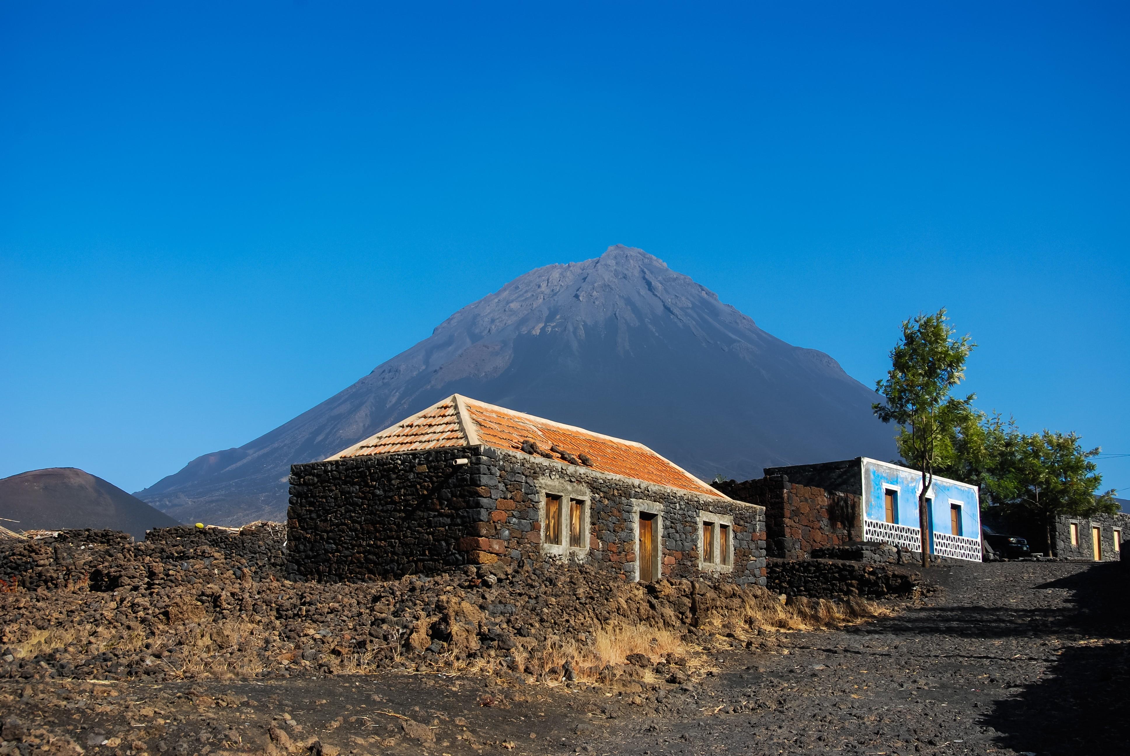
Chã das Caldeiras is a small village located inside the vast caldera of the active Pico do Fogo volcano on the island of Fogo in Cabo Verde (Cape Verde). It is one of the world's few permanent settlements within an active volcanic crater and is renowned for its dramatic volcanic scenery, resilient community, and distinctive agriculture, especially its locally produced wine and coffee. Living here means coexisting with volcanic activity. Major eruptions in 1995 and 2014–2015 forced evacuations and destroyed large portions of the villages of Portela and Bangaeira beneath advancing lava flows. Despite these risks, many residents returned and rebuilt, drawn by their agricultural traditions, community ties, and the exceptionally fertile volcanic soils. The village is unusual within Cabo Verde because its cooler, higher-elevation climate supports crops that are difficult to grow elsewhere in the country. Farmers cultivate grapes, coffee, apples, figs, pomegranates, beans, potatoes, and other produce, while local cooperatives produce the well-known "Chã" wines, fruit spirits, preserves, goat cheese, and roasted Fogo coffee. These products have become an important part of both the local economy and the area's identity.
 Hike a volcano
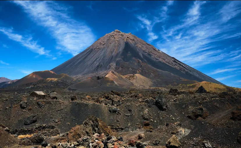
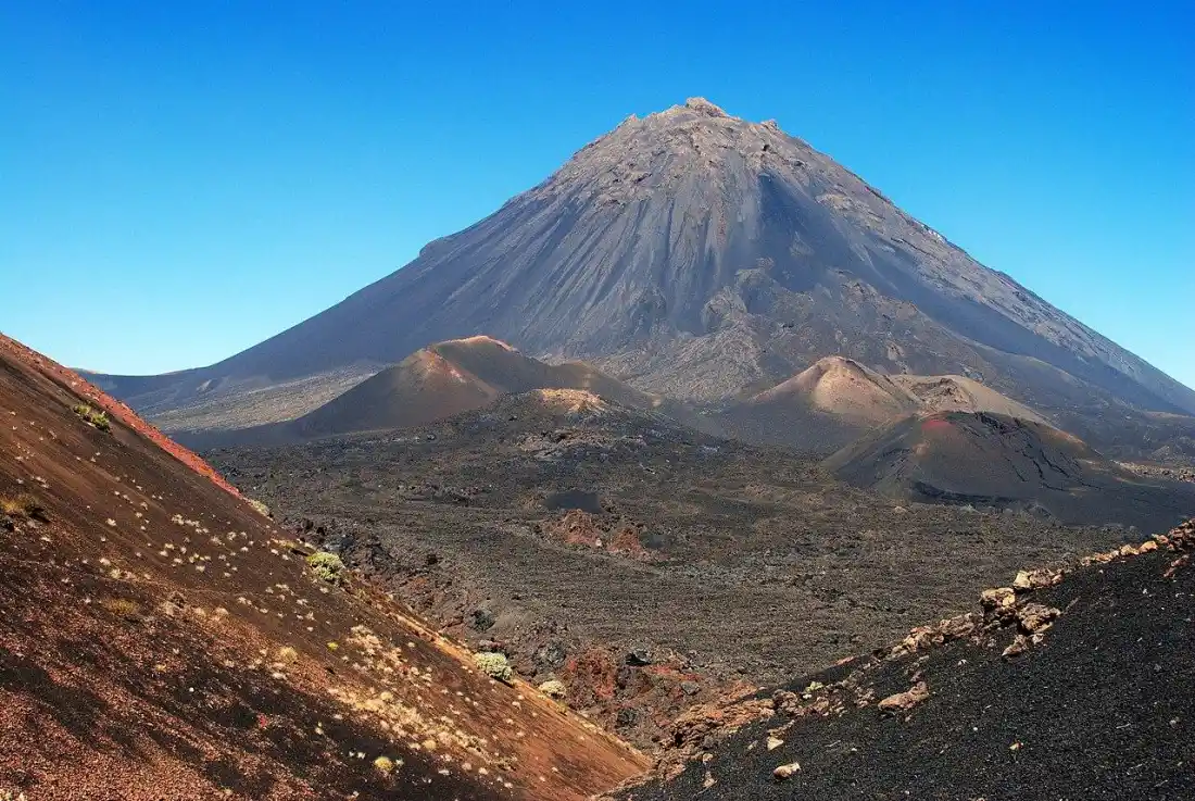
Pico do Fogo is the highest mountain and an active volcano in Cape Verde, rising from the center of Fogo Island. Standing at about 2,829 meters (9,281 feet), it is both the country's highest point and one of the most active volcanoes in the Atlantic, shaping the island's landscape, communities, and economy through repeated eruptions. Pico do Fogo sits within a vast caldera, a large volcanic depression formed by ancient collapses. Inside this caldera lies Chã das Caldeiras, a fertile plain where volcanic soils support vineyards, fruit trees, and farming despite the continuing volcanic risk. The volcano's steep cone, lava fields, and ash-covered terrain create one of Cape Verde's most striking natural landscapes. Many visitors hike from Chã das Caldeiras to the summit, a demanding climb that typically takes several hours and rewards hikers with panoramic views across Fogo Island and, on clear days, neighboring islands. Conditions can change quickly due to weather and volcanic hazards, so guided hikes are commonly recommended, and access may be restricted during periods of increased volcanic activity.