Travel to Mauritania


 4 photos
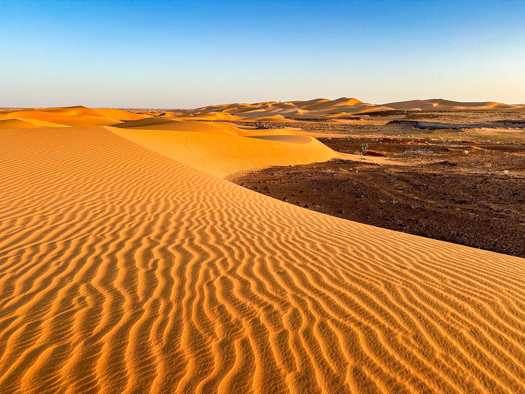
Mauritania, officially the Islamic Republic of Mauritania, is a large, sparsely populated country in northwest Africa. About 90% of its territory lies within the Sahara Desert, making it one of the driest nations in the region. It bridges North Africa’s Arab Berber Maghreb and sub-Saharan West Africa, both culturally and geographically.
Mauritania stretches from the Atlantic Ocean eastward into the interior Sahara, bordered by Western Sahara, Algeria, Mali, and Senegal. The landscape consists mostly of flat, sandy plains with scattered plateaus such as the Adrar and Tagant. The Senegal River valley supports limited agriculture and settlement. Environmental challenges include chronic drought, desertification, and soil erosion.
Hotels in Mauritania
 Chinguetti
Chinguetti is an ancient ksar (fortified desert town) in the Adrar Region of central Mauritania. Founded between the 11th and 13th centuries as a caravan hub on the trans-Saharan trade routes, it became a center of Islamic learning and pilgrimage. Today it is a UNESCO World Heritage Site and one of Mauritania’s most symbolic cultural landmarks. Founded by Sanhaja Berbers, Chinguetti thrived as a staging post for caravans trading salt, gold, and dates between North and sub-Saharan Africa. Its prominence grew in the 13th century as Mauritania’s spiritual capital, sometimes called the “seventh holiest city of Islam.” Pilgrims gathered here to begin the long journey to Mecca, and local scholars cultivated an enduring intellectual tradition.
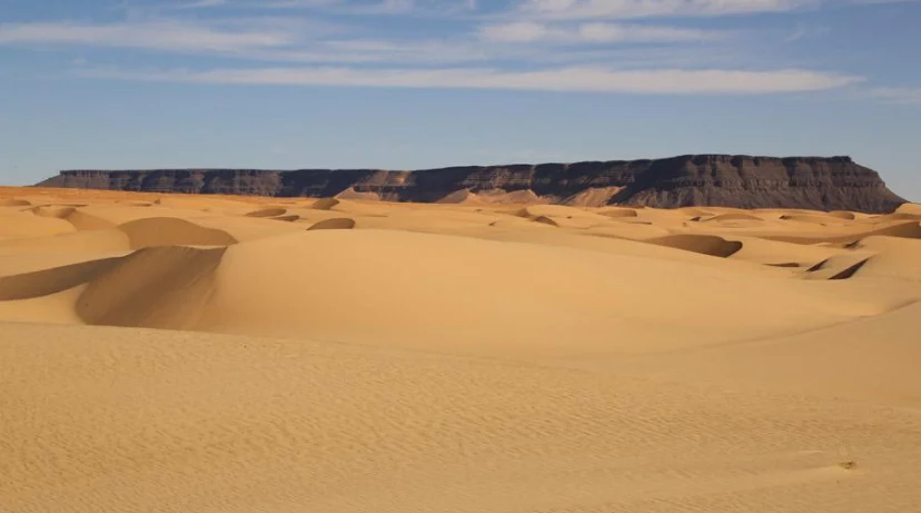
 Banc d’Arguin National Park
Banc d’Arguin National Park, on Mauritania’s Atlantic coast between Nouakchott and Nouadhibou, is one of Africa’s largest coastal reserves and a UNESCO World Heritage Site since 1989. Created in 1976, it protects a unique junction of Sahara desert dunes and nutrient-rich marine waters renowned for extraordinary biodiversity and migratory birds. Administered by the Parc National du Banc d’Arguin authority (PNBA), the site is also a Ramsar Convention wetland and a WWF “Gift to the Earth.” Major pressures include overfishing outside its boundaries, potential oil pollution, and climate change. Access requires permits and guides; visitors arrive by 4×4 from Nouakchott or Nouadhibou and can join guided bird-watching or eco-fishing excursions with Imraguen hosts. Strict rules limit disturbance to wildlife and ensure this desert-meets-ocean sanctuary remains one of West Africa’s most pristine natural landscapes.
Nouakchott
Nouakchott is the capital and largest city of Mauritania, located on the Atlantic coast of northwest Africa. It serves as the political, economic, and cultural center of the country and is one of the largest cities in the Sahara region. Originally a small coastal village, Nouakchott was designated as the capital of Mauritania upon independence from France in 1960. Its selection reflected a desire for a central, neutral location within the country’s diverse ethnic landscape. Rapid urban migration, especially from rural areas affected by droughts, led to a population boom far beyond initial plans.
 Mauritania Railway
The Mauritania Railway is a 704 km single-track, standard-gauge line that runs across the Sahara Desert, connecting the iron-ore mines at Zouérat in northern Mauritania with the Atlantic port of Nouadhibou. Operated by the state-owned mining company Société Nationale Industrielle et Minière (SNIM), it forms the backbone of the country’s industrial transport system and is famous for operating some of the world’s longest and heaviest trains. Running from Zouérat through Fderik and Choum to Nouadhibou, the line crosses barren desert terrain and briefly traverses territory of Western Sahara. It was constructed to export iron ore, which accounts for roughly half of Mauritania’s exports. Trains typically reach lengths of 2.5 to 3 km, hauled by multiple EMD diesel-electric locomotives, with each of the 200-plus wagons carrying up to 84 tons of ore.
The Richat Structure, also known as the “Eye of the Sahara” or “Eye of Africa,” is a vast circular geological formation in the Adrar Region of central Mauritania. Spanning roughly 40–50 kilometers (25–30 miles) across, it is one of the Sahara Desert’s most recognizable landmarks, visible from space as a concentric bull’s-eye pattern. The Richat Structure formed when molten rock uplifted overlying layers of sediment during the Cretaceous Period. Over millions of years, wind and water erosion stripped away the upper layers, revealing concentric rings of rock with alternating hardness. The oldest rocks occupy the center, while younger strata form the outer circles. This erosion exposed a striking pattern of layers, including igneous intrusions and sedimentary beds.